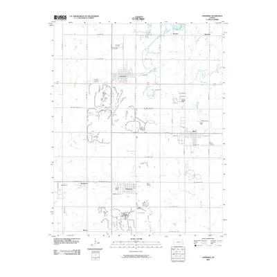
2009 Map of Cherokee
USGS Topo · Published 2009About this map
Cherokee and Weir serve as the primary hubs in this Southeast Kansas landscape, where the grid of rural roads connects several smaller communities and family heritage sites. The terrain is marked by the drainage patterns of Wolf Creek and Brush Creek in the north, while the southern portion of the quadrangle is defined by the headwaters of Little Cherry Creek and Little Shawnee Creek. This 2009 survey highlights a significant concentration of local burial grounds, including Cherokee Cemetery, Hosey Hill Cemetery, and Saint Anthony Cemetery, which provide essential touchpoints for genealogical research in the area. Smaller named locales such as Roseland, Scammon, and the crossroads at Klondike illustrate the historic settlement density of the county, while features like Daisy Hill and Mackie indicate the persistent naming of specific localities within the agricultural and residential landscape.
Find a feature on this map
64 named features on this map. Tap any name to fly to it.
Don’t see what you’re looking for? This feature index may not catch every label — zoom into the map to look around manually.
Map Details
Editions of this 2009 Cherokee Map
This is the sole edition of this map. No revisions or reprints were ever made.
Other maps of this area

1886 · Joplin
USGS Topo · 1:125,000

1894 · Joplin
USGS Topo · 1:125,000

1918 · Columbus
USGS Topo · 1:62,500

1943 · Cherokee
USGS Topo · 1:62,500

1945 · Pittsburg
USGS Topo · 1:62,500

1945 · Cherokee
USGS Topo · 1:62,500

1947 · Joplin
USGS Topo · 1:250,000

1947 · Pittsburg
USGS Topo · 1:62,500

1949 · Joplin
USGS Topo · 1:250,000

1950 · Pittsburg
USGS Topo · 1:62,500