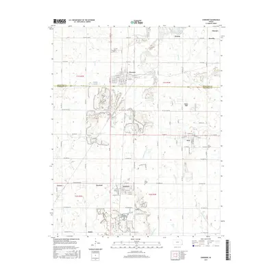
2015 Map of Cherokee
USGS Topo · Published 2015About this map
Cherokee and Weir serve as the primary hubs in this southeastern Kansas landscape, where a dense grid of section roads and small-town plats reveals the region's historic mining and agricultural footprint. The topography is marked by several water bodies, including Cherokee Tank and the meandering paths of Cherry Cr and Little Shawnee Cr. Clusters of smaller settlements like Scammon, Roseland, and Carona are situated in close proximity, suggesting a legacy of concentrated labor and transport centers. Several local burial sites, such as Hosey Hill Cem and Saint Bridget Cem, provide valuable landmarks for genealogical research. The map illustrates the transition from urban street grids to the open reaches along NE Coal Valley Rd, reflecting the spatial organization of Crawford and Cherokee counties.
Find a feature on this map
62 named features on this map. Tap any name to fly to it.
Don’t see what you’re looking for? This feature index may not catch every label — zoom into the map to look around manually.
Map Details
Editions of this 2015 Cherokee Map
This is the sole edition of this map. No revisions or reprints were ever made.
Other maps of this area

1886 · Joplin
USGS Topo · 1:125,000

1894 · Joplin
USGS Topo · 1:125,000

1918 · Columbus
USGS Topo · 1:62,500

1943 · Cherokee
USGS Topo · 1:62,500

1945 · Pittsburg
USGS Topo · 1:62,500

1945 · Cherokee
USGS Topo · 1:62,500

1947 · Joplin
USGS Topo · 1:250,000

1947 · Pittsburg
USGS Topo · 1:62,500

1949 · Joplin
USGS Topo · 1:250,000

1950 · Pittsburg
USGS Topo · 1:62,500