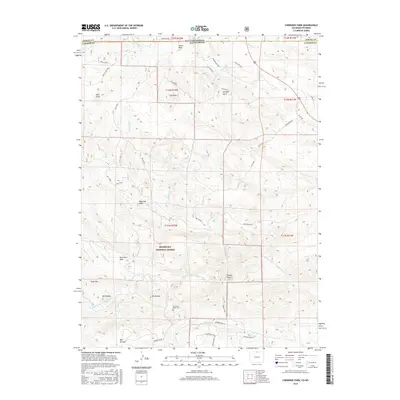
2016 Map of Cherokee Park
USGS Topo · Published 2016About this map
The N Fork Cache La Poudre River winds through the southern reaches of this landscape, a region defined by high-altitude granite formations and the dense timber of the Roosevelt National Forest. The settlement of Cherokee Park sits near the river's path, serving as a focal point for a network of rural roads such as Cherokee Park Rd and Moen Ranch Rd. The terrain is punctuated by significant peaks and rock outcroppings, including Goat Mtn, Mt Kimball, and the prominent Bull Rock. For those researching local history or genealogy, the presence of the Trails End Ranch Cem near the Prairie Divide provides a specific point of interest. This area, spanning the Wyoming and Colorado border, showcases a transition from open gulches like Georges Gulch to the complex drainage systems of Mill Creek and Fish Cr.
Find a feature on this map
52 named features on this map. Tap any name to fly to it.
Don’t see what you’re looking for? This feature index may not catch every label — zoom into the map to look around manually.
Map Details
Editions of this 2016 Cherokee Park Map
This is the sole edition of this map. No revisions or reprints were ever made.
Other maps of this area

1895 · Laramie
USGS Topo · 1:125,000

1902 · Laramie
USGS Topo · 1:125,000

1905 · Sherman
USGS Topo · 1:125,000

1905 · Laramie
USGS Topo · 1:125,000

1906 · Laramie
USGS Topo · 1:125,000

1907 · Livermore
USGS Topo · 1:125,000

1908 · Laramie
USGS Topo · 1:125,000

1909 · Livermore
USGS Topo · 1:125,000

1916 · Home
USGS Topo · 1:125,000

1920 · Home
USGS Topo · 1:125,000