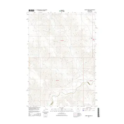
2015 Map of Cherry Creek NW
USGS Topo · Published 2015About this map
Cheyenne River flows across the southern portion of this landscape, marking the boundary between Ziebach and Haakon counties. The terrain is defined by a dense network of drainages, including Cottonwood Cr and Little Cottonwood Cr, which carve through the high plains. A prominent landmark, Joshua Butte, rises in the northeast corner, providing a clear navigational point in this expansive prairie. Transportation is limited to a handful of routes, most notably Bia-12 and the family-named Tipi J Rd. This map captures a moment in the modern era of these tribal lands and rural ranching tracts, where the natural water systems remain the primary structural features of the geography.
Find a feature on this map
12 named features on this map. Tap any name to fly to it.
Don’t see what you’re looking for? This feature index may not catch every label — zoom into the map to look around manually.
Map Details
Editions of this 2015 Cherry Creek NW Map
This is the sole edition of this map. No revisions or reprints were ever made.
Other maps of this area

1954 · Pierre
USGS Topo · 1:250,000

1955 · Rattlesnake Lake SE
USGS Topo · 1:24,000

1955 · Rattlesnake Lake NE
USGS Topo · 1:24,000

1956 · Kirley
USGS Topo · 1:24,000

1956 · Cherry Creek NW
USGS Topo · 1:24,000

1956 · Carlin Flat
USGS Topo · 1:24,000

1956 · Cherry Creek
USGS Topo · 1:24,000

1958 · Pierre
USGS Topo · 1:250,000

1981 · High Elk Hill SE
USGS Topo · 1:24,000

1981 · High Elk Hill SW
USGS Topo · 1:24,000