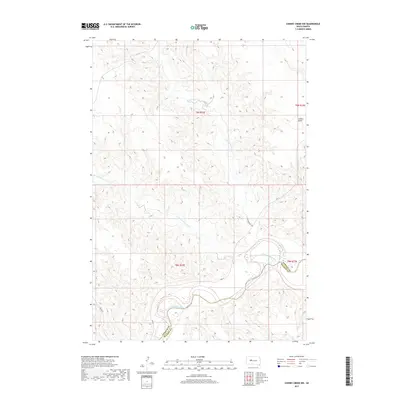
2017 Map of Cherry Creek NW
USGS Topo · Published 2017About this map
Cheyenne River flows through this prairie landscape at the border of Ziebach and Haakon counties. The terrain is defined by an intricate network of drainage systems, including the branching paths of Little Cottonwood Cr and Cottonwood Cr. Rising above the surrounding drainage basins, Joshua Butte serves as a prominent landmark on the eastern edge of the quadrangle. Transport through this sparsely populated region is facilitated by routes like BIA Hwy 5 and Rte 12, which traverse the high ground between the river and its northern tributaries. The map's detail illustrates the complex relationship between the watercourses and the high plains, showing how Deep Cr and other smaller streams have etched deep patterns into the South Dakota soil.
Find a feature on this map
13 named features on this map. Tap any name to fly to it.
Don’t see what you’re looking for? This feature index may not catch every label — zoom into the map to look around manually.
Map Details
Editions of this 2017 Cherry Creek NW Map
This is the sole edition of this map. No revisions or reprints were ever made.
Other maps of this area

1954 · Pierre
USGS Topo · 1:250,000

1955 · Rattlesnake Lake SE
USGS Topo · 1:24,000

1955 · Rattlesnake Lake NE
USGS Topo · 1:24,000

1956 · Kirley
USGS Topo · 1:24,000

1956 · Cherry Creek NW
USGS Topo · 1:24,000

1956 · Carlin Flat
USGS Topo · 1:24,000

1956 · Cherry Creek
USGS Topo · 1:24,000

1958 · Pierre
USGS Topo · 1:250,000

1981 · High Elk Hill SE
USGS Topo · 1:24,000

1981 · High Elk Hill SW
USGS Topo · 1:24,000