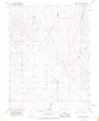
1965 Map of Cherry Creek SE
USGS Topo · Published 1967About this map
Buffalo Valley dominates this 1965 survey, a basin where three Nevada counties—Pershing, Humboldt, and Lander—converge. The arid terrain is primarily shaped by seasonal drainage patterns, most notably Cherry Creek and Timber Creek, which descend from the surrounding high ground toward the valley floor. In the southeastern portion of the quadrangle, a lone Prospect indicates the mineral exploration typical of the region during this mid-century period. The map meticulously records numerous elevation benchmarks (BM) and unimproved dirt tracks that served as the primary transit routes through this sparse landscape, providing a clear record of the area's geography before later development or land-use changes.
Find a feature on this map
7 named features on this map. Tap any name to fly to it.
Don’t see what you’re looking for? This feature index may not catch every label — zoom into the map to look around manually.
Map Details
Editions of this 1965 Cherry Creek SE Map
2 editions found
Other maps of this area

1932 · Sonoma Range
USGS Topo · 1:250,000

1939 · Sonoma Range
USGS Topo · 1:250,000

1940 · Antler Peak
USGS Topo · 1:62,500

1943 · Antler Peak
USGS Topo · 1:62,500

1955 · Winnemucca
USGS Topo · 1:250,000

1958 · Winnemucca
USGS Topo · 1:250,000

1961 · McCoy
USGS Topo · 1:62,500

1962 · Winnemucca
USGS Topo · 1:250,000

1962 · Buffalo Springs
USGS Topo · 1:62,500
1965 · Cherry Creek NE
USGS Topo · 1:24,000