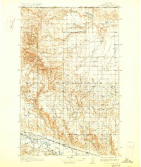
1913 Map of Cherry Ridge
USGS Topo · Published 1928About this map
The United States Canada Boundary Line defines the northern edge of this northern Montana landscape, where the terrain transitions from the high elevations of Cherry Patch Ridge down to the fertile valley of the Milk River. This early 20th-century survey shows a region shaped by cattle ranching and early irrigation efforts, with dispersed landmarks like Sorters Ranch, Arbogasts Ranch, and Nickols Ranch serving as focal points for the rural population. The southern portion of the sheet is dominated by the Fort Belknap Indian Reservation and the infrastructure of the Great Northern railroad, which parallels the river. Water management is evident through the presence of the Harlem Canal, while natural features like Woody Island Coulee and Thirty-mile Creek drain the undulating plains between the prominent peaks of West Butte and Middle Butte.
Find a feature on this map
23 named features on this map. Tap any name to fly to it.
Don’t see what you’re looking for? This feature index may not catch every label — zoom into the map to look around manually.
Map Details
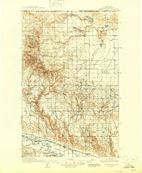
Editions of this 1913 Cherry Ridge Map
3 editions found
Other maps of this area

1903 · Wayne Creek
USGS Topo · 1:62,500

1904 · Chinook
USGS Topo · 1:62,500

1905 · Wayne Creek
USGS Topo · 1:62,500

1905 · Harlem
USGS Topo · 1:62,500

1912 · Zurich
USGS Topo · 1:125,000

1913 · Cherry Ridge
USGS Topo · 1:125,000

1920 · Avery
USGS Topo · 1:125,000

1953 · Havre
USGS Topo · 1:250,000

1956 · Cleveland
USGS Topo · 1:62,500

1957 · Havre
USGS Topo · 1:250,000