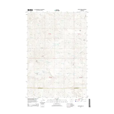
2014 Map of Cherry Spring
USGS Topo · Published 2014About this map
Bull Mountains topography and high-plains ranch land define this portion of the border between Musselshell and Yellowstone Counties. The landscape is marked by a complex network of coulees and gulches, including Carters Coulee and Tepee Coulee, which channel drainage toward Hawk Cr and its tributaries. While the region is arid, numerous small springs such as Cherry Spring and various unnamed sources identified by their township and range coordinates indicate the critical importance of water access for local livestock operations like the 7 P K Ranch. Prominent geological landmarks, notably Square Butte and Three Buttes, serve as natural navigational markers across the undulating terrain. A sparse network of rural roads, including Fishel Creek Rd and Hawk Creek Rd, provides the primary access to these remote ranching outposts.
Find a feature on this map
48 named features on this map. Tap any name to fly to it.
Don’t see what you’re looking for? This feature index may not catch every label — zoom into the map to look around manually.
Map Details
Editions of this 2014 Cherry Spring Map
This is the sole edition of this map. No revisions or reprints were ever made.
Other maps of this area

1954 · Roundup
USGS Topo · 1:250,000

1958 · Roundup
USGS Topo · 1:250,000

1979 · Roundup
USGS Topo · 1:100,000

1979 · Corey Flat
USGS Topo · 1:24,000

1979 · Gage NE
USGS Topo · 1:24,000

1979 · Chimney Butte
USGS Topo · 1:24,000
1980 · P K Ranch NE
USGS Topo · 1:24,000
1980 · Steamboat Butte
USGS Topo · 1:24,000

1980 · Cherry Spring
USGS Topo · 1:24,000

1980 · Dunn Mountain South
USGS Topo · 1:24,000