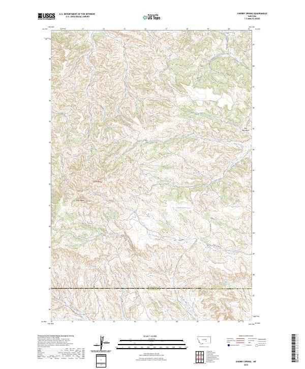
2024 Map of Cherry Spring
USGS Topo · Published 2024About this map
Square Butte and Three Buttes command the central landscape of this Montana quadrangle, where the Musselshell Co and Yellowstone Co border cuts across the southern drainage. The terrain is defined by the high elevations of the Bull Mountains, dissected by a complex network of coulees and gulches. Significant water sources like Cherry Spring and the 06N28E01CBCC01 Spring are tucked within these draws, feeding systems such as Carters Coulee and Hawk Creek. A sparse network of rural routes, including Fishel Creek Rd and Roen Rd, provides the only access through this dissected country. The map captures a moment of modern land management where township and range lines meet physical landmarks like Cow Gulch and Dutch Oven Creek, illustrating the intersection of cadastral survey and the high plains environment.
Find a feature on this map
22 named features on this map. Tap any name to fly to it.
Don’t see what you’re looking for? This feature index may not catch every label — zoom into the map to look around manually.
Map Details
Editions of this 2024 Cherry Spring Map
This is the sole edition of this map. No revisions or reprints were ever made.
Other maps of this area

1954 · Roundup
USGS Topo · 1:250,000

1958 · Roundup
USGS Topo · 1:250,000

1979 · Roundup
USGS Topo · 1:100,000

1979 · Corey Flat
USGS Topo · 1:24,000

1979 · Gage NE
USGS Topo · 1:24,000

1979 · Chimney Butte
USGS Topo · 1:24,000
1980 · P K Ranch NE
USGS Topo · 1:24,000
1980 · Steamboat Butte
USGS Topo · 1:24,000

1980 · Cherry Spring
USGS Topo · 1:24,000

1980 · Dunn Mountain South
USGS Topo · 1:24,000