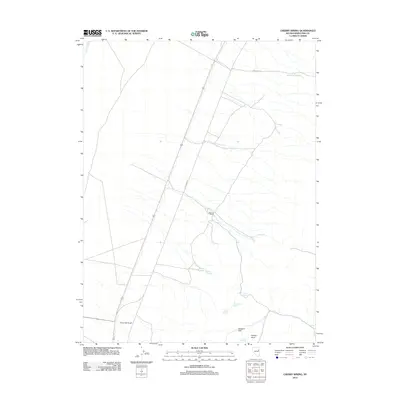
2012 Map of Cherry Spring
USGS Topo · Published 2012About this map
The J Henroid Ranch stands as a primary point of human activity in this arid White Pine County landscape, where water sources dictate the placement of local landmarks. The area's reliance on groundwater is evident through a series of named watering points including Woodcamp Spring, Cherry Spring, and Indian Springs. Transportation is defined by the corridor of US Route 93 and the nearby path of Old Hwy 93, tracing a route through the high desert floor between distinctive landforms. Elevation changes are marked by features such as Fortymile Knoll and Chicken Knoll, which rise above the level terrain of Brewers Flat. This 2012 survey illustrates the sparse but critical network of springs and ranching infrastructure that supports life in the Great Basin, reflecting a landscape that has changed little in its basic geographic requirements over many decades.
Find a feature on this map
13 named features on this map. Tap any name to fly to it.
Don’t see what you’re looking for? This feature index may not catch every label — zoom into the map to look around manually.
Map Details
Editions of this 2012 Cherry Spring Map
This is the sole edition of this map. No revisions or reprints were ever made.
Other maps of this area

1955 · Elko
USGS Topo · 1:250,000

1956 · Ely
USGS Topo · 1:250,000

1958 · Elko
USGS Topo · 1:250,000

1959 · Ely
USGS Topo · 1:250,000

1962 · Elko
USGS Topo · 1:250,000

1963 · Ely
USGS Topo · 1:250,000

1965 · Elko
USGS Topo · 1:250,000

1982 · Borchert Spring
USGS Topo · 1:24,000

1982 · Cherry Spring
USGS Topo · 1:24,000
1982 · Goshute Lake South
USGS Topo · 1:24,000