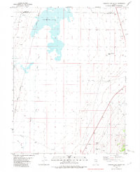
1982 Map of Goshute Lake South
USGS Topo · Published 1982About this map
Goshute Lake dominates this Great Basin landscape along the border of Elko and White Pine counties. This arid interior basin is defined by the ephemeral presence of water and the linear infrastructure of early 20th-century transport. The Nevada Northern railroad line runs along the western edge of the valley, passing through the settlement of Greens. The importance of water in this high-desert environment is evidenced by remote water sources like Collar and Elbow Spring and various unnamed springs feeding into Duck Creek. Industry is represented by several Gravel Pit and Gravel Pits sites, likely supporting the maintenance of the rail corridor and the scattered Jeep Trail and Jeep Road networks that crisscross the valley floor. A lone Substa indicates the reach of the regional power grid across this sparsely populated high-altitude terrain.
Find a feature on this map
12 named features on this map. Tap any name to fly to it.
Don’t see what you’re looking for? This feature index may not catch every label — zoom into the map to look around manually.
Map Details
Editions of this 1982 Goshute Lake South Map
This is the sole edition of this map. No revisions or reprints were ever made.
Other maps of this area

1955 · Elko
USGS Topo · 1:250,000

1956 · Ely
USGS Topo · 1:250,000

1958 · Elko
USGS Topo · 1:250,000

1959 · Ely
USGS Topo · 1:250,000

1962 · Elko
USGS Topo · 1:250,000

1963 · Ely
USGS Topo · 1:250,000

1965 · Elko
USGS Topo · 1:250,000

1982 · Cherry Spring
USGS Topo · 1:24,000
1982 · Goshute Lake NE
USGS Topo · 1:24,000
1982 · Becky Peak
USGS Topo · 1:24,000