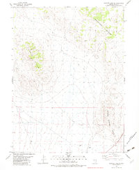
1982 Map of Goshute Lake NE
USGS Topo · Published 1982About this map
The Antelope Range and Currie Hills define the high-desert character of this Elko County landscape as it appeared in the early 1980s. This survey focuses on a remote section of eastern Nevada, where the terrain is marked by significant topographical relief and sparse infrastructure. Industrial activity is localized near the southern edge of the sheet, evidenced by a Gravel Pit and Gravel Pits located east of a solitary Well.
Find a feature on this map
10 named features on this map. Tap any name to fly to it.
Don’t see what you’re looking for? This feature index may not catch every label — zoom into the map to look around manually.
Map Details
Editions of this 1982 Goshute Lake NE Map
This is the sole edition of this map. No revisions or reprints were ever made.
Other maps of this area

1955 · Elko
USGS Topo · 1:250,000

1958 · Elko
USGS Topo · 1:250,000

1962 · Elko
USGS Topo · 1:250,000

1965 · Elko
USGS Topo · 1:250,000

1982 · Currie
USGS Topo · 1:24,000

1982 · Chin Creek Spring
USGS Topo · 1:24,000
1982 · Boone Canyon
USGS Topo · 1:24,000

1982 · Sharp Peak
USGS Topo · 1:24,000
1982 · Dolly Varden Spring
USGS Topo · 1:24,000
1982 · Goshute Lake South
USGS Topo · 1:24,000