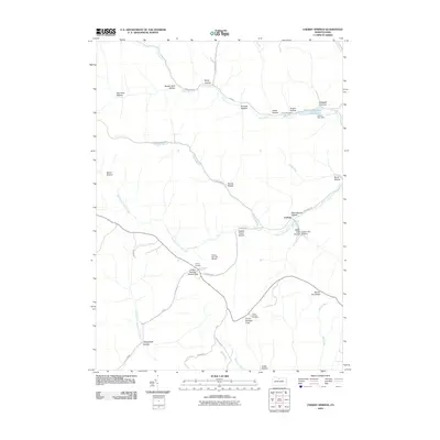
2010 Map of Cherry Springs
USGS Topo · Published 2010About this map
Cherry Springs and the small settlement of Corbett anchor this high-plateau landscape in Potter County. The terrain is defined by an intricate network of narrow valleys, or hollows, including Schoolhouse Hollow, Shinglebolt Hollow, and Splash Dam Hollow, the latter hinting at the region's legacy of timber splash dams. Public recreation and conservation are central to the area's identity, evidenced by the Cherry Springs Scenic Area and the high-elevation Cherry Springs Airport. In the north, Lyman Run Reservoir and its associated dam break the dense woodland, while various lookouts like Cherry Springs Vista and the Cherry Springs Fire Tower provide vantage points over the headwaters of the West Branch Pine Creek and the East Fork Sinnemahoning Creek.
Find a feature on this map
46 named features on this map. Tap any name to fly to it.
Don’t see what you’re looking for? This feature index may not catch every label — zoom into the map to look around manually.
Map Details
Editions of this 2010 Cherry Springs Map
This is the sole edition of this map. No revisions or reprints were ever made.
Other maps of this area

1899 · Gaines
USGS Topo · 1:62,500

1900 · Gaines
USGS Topo · 1:62,500

1932 · Genesee
USGS Topo · 1:62,500

1937 · Genesee
USGS Topo · 1:62,500

1947 · Conrad
USGS Topo · 1:62,500

1947 · Galeton
USGS Topo · 1:62,500

1947 · Conrad
USGS Topo · 1:24,000

1947 · Short Run
USGS Topo · 1:24,000

1947 · Ayers Hill
USGS Topo · 1:24,000
1947 · Oleona
USGS Topo · 1:24,000
Featured Places
- Sweden Township, PA
- Abbott Township, PA
- Wharton Township, PA
- Ulysses Township, PA
- West Branch Township, PA