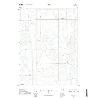
2019 Map of Cherry Valley
USGS Topo · Published 2019About this map
Pymatuning Cr and Mosquito Cr define the hydrological character of this portion of Ashtabula County, where a network of township roads connects small rural settlements. The landscape is dotted with several family and community burial grounds, including the centrally located Hayes Cem and Center Cem, which offer significant value for genealogical research in this corner of Ohio. Settlement patterns are concentrated around the intersections of state and county routes, most notably at Cherry Valley and the smaller hamlets of Wick and Wayne. The map details a transition between agricultural land and wooded wetlands, particularly surrounding Galicki Pond and Jeffco Lake. This grid of roads, such as Dodgeville Rd and Cream Ridge Rd, reflects a persistent agrarian layout maintained well into the twenty-first century.
Find a feature on this map
47 named features on this map. Tap any name to fly to it.
Don’t see what you’re looking for? This feature index may not catch every label — zoom into the map to look around manually.
Map Details
Editions of this 2019 Cherry Valley Map
This is the sole edition of this map. No revisions or reprints were ever made.
Other maps of this area

1905 · Andover
USGS Topo · 1:48,000

1905 · Bristolville
USGS Topo · 1:62,500

1905 · Jefferson
USGS Topo · 1:62,500

1907 · Andover
USGS Topo · 1:62,500

1907 · Kinsman
USGS Topo · 1:62,500

1907 · Bristolville
USGS Topo · 1:62,500

1907 · Jefferson
USGS Topo · 1:62,500

1950 · Cleveland
USGS Topo · 1:250,000

1956 · Cleveland
USGS Topo · 1:250,000

1959 · Dorset
USGS Topo · 1:24,000