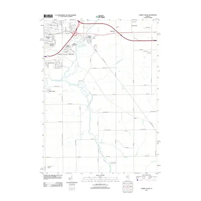
2012 Map of Cherry Valley
USGS Topo · Published 2012About this map
Cherry Valley serves as the central hub of this 2012 survey, where the Kishwaukee River and its South Branch meet. The landscape reflects a mix of suburban expansion and agricultural persistence, evidenced by residential clusters like Panorama Valley, Coventry Hills East, and the Beiler Subdivision. Local history is anchored by several burial grounds, including Arlington Memorial Park Cem, Carman Cem, and Flora Cem. Aviation activity is marked by small fields such as Cheechako Airport and Rotstein Airport in the south. The infrastructure is characterized by a dense network of roads like S Perryville Rd and S Bell School Rd that weave between older landmarks like Valley View Farm and the settlement of Irene.
Find a feature on this map
95 named features on this map. Tap any name to fly to it.
Don’t see what you’re looking for? This feature index may not catch every label — zoom into the map to look around manually.
Map Details
Editions of this 2012 Cherry Valley Map
This is the sole edition of this map. No revisions or reprints were ever made.
Other maps of this area

1917 · Kings
USGS Topo · 1:62,500

1918 · Rockford
USGS Topo · 1:62,500

1918 · Belvidere
USGS Topo · 1:62,500

1918 · Kings
USGS Topo · 1:62,500

1918 · Kirkland
USGS Topo · 1:62,500

1938 · Rockford
USGS Topo · 1:62,500

1944 · Belvidere
USGS Topo · 1:62,500

1949 · Camp Grant
USGS Topo · 1:24,000

1949 · Rockford
USGS Topo · 1:24,000

1954 · Rockford
USGS Topo · 1:250,000