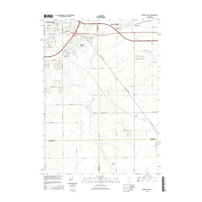
2015 Map of Cherry Valley
USGS Topo · Published 2015About this map
The Kishwaukee River and its South Branch serve as the primary geographical anchors for this region southeast of Rockford. This 2015 study illustrates the suburban character of the area, particularly around the village of Cherry Valley, where commercial developments like the Cherry Vale Mall area meet older residential pockets. The map documents a transition from the dense street grids of eastern Rockford, featuring corridors like Harrison Ave and Charles St, to the more expansive agricultural and rural residential tracts of the Illinois prairie.
Find a feature on this map
80 named features on this map. Tap any name to fly to it.
Don’t see what you’re looking for? This feature index may not catch every label — zoom into the map to look around manually.
Map Details
Editions of this 2015 Cherry Valley Map
This is the sole edition of this map. No revisions or reprints were ever made.
Other maps of this area

1917 · Kings
USGS Topo · 1:62,500

1918 · Rockford
USGS Topo · 1:62,500

1918 · Belvidere
USGS Topo · 1:62,500

1918 · Kings
USGS Topo · 1:62,500

1918 · Kirkland
USGS Topo · 1:62,500

1938 · Rockford
USGS Topo · 1:62,500

1944 · Belvidere
USGS Topo · 1:62,500

1949 · Camp Grant
USGS Topo · 1:24,000

1949 · Rockford
USGS Topo · 1:24,000

1954 · Rockford
USGS Topo · 1:250,000