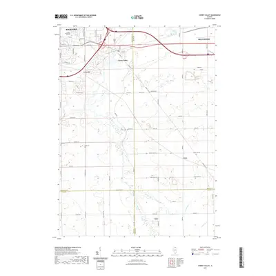
2021 Map of Cherry Valley
USGS Topo · Published 2021About this map
Cherry Valley serves as a central hub in this landscape between Rockford and Belvidere, where the urban expansion of the Kishwaukee River valley meets the rolling agricultural lands of eastern Winnebago County. The topography is defined by the winding course of Trimble Run and Bessie Cr, which drain toward the south across a network of country roads. Local history is deeply embedded in the land, evidenced by a high density of rural burial grounds such as Flora Cem, Shirley Cem, and Dodge Cem. The presence of Rotstein Airport and the small settlement of Irene highlight the area's mixed identity as both a suburban corridor and a persistent farming community. Genealogists and local historians will find the specific road names, such as Bloomberg Rd and Sweeney Rd, invaluable for tracing family landholdings in this part of northern Illinois.
Find a feature on this map
68 named features on this map. Tap any name to fly to it.
Don’t see what you’re looking for? This feature index may not catch every label — zoom into the map to look around manually.
Map Details
Editions of this 2021 Cherry Valley Map
This is the sole edition of this map. No revisions or reprints were ever made.
Other maps of this area

1917 · Kings
USGS Topo · 1:62,500

1918 · Rockford
USGS Topo · 1:62,500

1918 · Belvidere
USGS Topo · 1:62,500

1918 · Kings
USGS Topo · 1:62,500

1918 · Kirkland
USGS Topo · 1:62,500

1938 · Rockford
USGS Topo · 1:62,500

1944 · Belvidere
USGS Topo · 1:62,500

1949 · Camp Grant
USGS Topo · 1:24,000

1949 · Rockford
USGS Topo · 1:24,000

1954 · Rockford
USGS Topo · 1:250,000