2024 Map of Cherry Valley
USGS Topo · Published 2024About this map
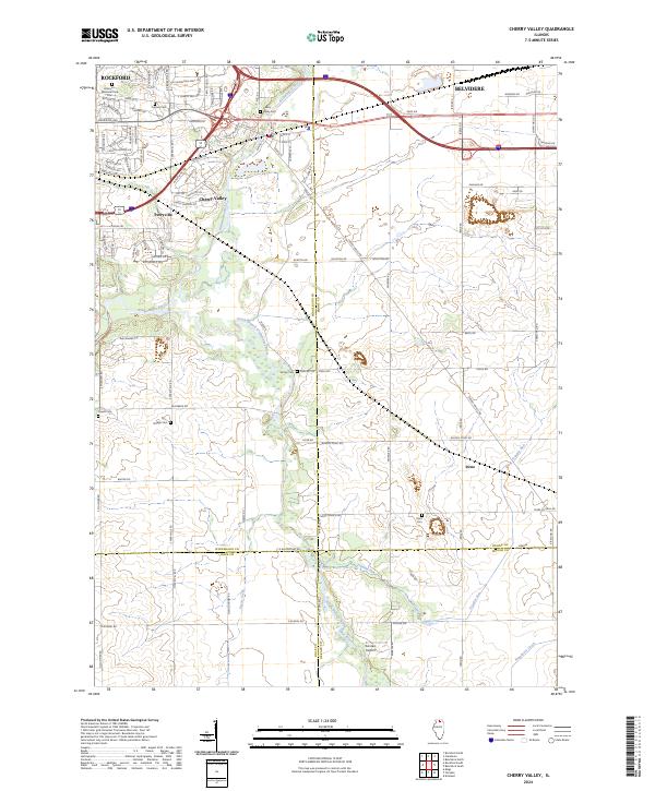
The Kishwaukee River and its South Branch serve as the central geographic features of this Northern Illinois landscape, where the urban expansion of Rockford and Belvidere meets the agricultural reaches of several counties. The village of Cherry Valley sits at a critical junction near where the two river branches converge, a point that has historically defined local transportation and settlement patterns. The map detail highlights several rural hubs such as Perryville and Irene, alongside smaller landmarks like Rotstein Airport. For genealogists and local historians, the sheet is particularly valuable for its documentation of numerous burial sites, including Arlington Memorial Park Cem, Cherry Valley Cem, and more isolated family or community grounds like Powell Cem, Dodge Cem, and Shirley Cem. This modern topographic survey illustrates how the contemporary road network, including W State St and S Perryville Rd, overlays an older landscape defined by creek drainage and county boundary lines.
Find a feature on this map
103 named features on this map. Tap any name to fly to it.
Don’t see what you’re looking for? This feature index may not catch every label — zoom into the map to look around manually.
Map Details
Editions of this 2024 Cherry Valley Map
This is the sole edition of this map. No revisions or reprints were ever made.
Historical Maps of Thorne Ledge Through Time
Featured Locations
- Franklin Township, IL
- Flora Township, IL
- Belvidere Township, IL
- Rockford, Rockford Township
- Belvidere, Belvidere Township