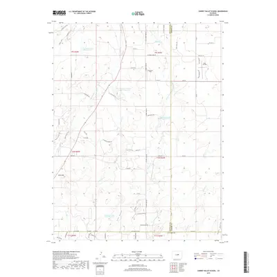
2019 Map of Cherry Valley School
USGS Topo · Published 2019About this map
W Cherry Cr and E Cherry Cr carve through the high terrain where the borders of Douglas, Elbert, and El Paso counties converge. This 2019 survey captures a landscape defined by significant water management infrastructure, including the Franktown Parker FPA-2 Reservoir and the West Cherry Cr Detention Number 11-Reservoir. The topography is marked by notable elevations such as Bucks Mtn and deep incisions like Iron Gulch and Neffs Gulch. Aviation history is present at Kelly Air Park and Ambrosich Field, while the recreational and transit network is represented by the Palmer Divide Trail and Diamond K Ranch Rd. This map reveals a transition from traditional ranching lands to contemporary water conservation and private airfield developments.
Find a feature on this map
66 named features on this map. Tap any name to fly to it.
Don’t see what you’re looking for? This feature index may not catch every label — zoom into the map to look around manually.
Map Details
Editions of this 2019 Cherry Valley School Map
This is the sole edition of this map. No revisions or reprints were ever made.
Other maps of this area

1894 · Castle Rock
USGS Topo · 1:125,000

1913 · Castle Rock
USGS Topo · 1:125,000

1939 · Elizabeth
USGS Topo · 1:62,500

1940 · Elbert
USGS Topo · 1:62,500

1940 · Castle Rock
USGS Topo · 1:62,500

1944 · Elbert
USGS Topo · 1:62,500

1945 · Castle Rock
USGS Topo · 1:62,500

1945 · Elizabeth
USGS Topo · 1:62,500

1953 · Denver
USGS Topo · 1:250,000

1954 · Cherry Valley School
USGS Topo · 1:24,000