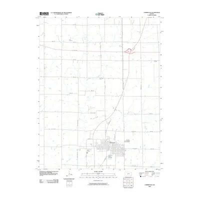
2009 Map of Cherryvale
USGS Topo · Published 2009About this map
Cherryvale stands as the primary hub of this landscape, its grid of streets defined by a dense network of thoroughfares like Front St and Martin St. The settlement's infrastructure is anchored by the Cherryvale City Lake Dam to the south and the Tri-City Airport to the northeast, reflecting a mid-continental crossroads of aviation and surface transport. This 2009 survey shows a region where the traditional section-line road grid, including 6400 Rd and Anderson Rd, is overlaid by modern transit corridors such as US Hwy 169 and US Hwy 400. For genealogists, the map preserves the locations of several burial grounds, including Hiltz Cemetery in the north and the Saint Francis Xavier Cemetery and Fairview Cemetery near the city center. The drainage patterns of Chateau Creek and Drum Creek meander across the prairie, illustrating the natural geography that dictated early land use in Labette County.
Find a feature on this map
50 named features on this map. Tap any name to fly to it.
Don’t see what you’re looking for? This feature index may not catch every label — zoom into the map to look around manually.
Map Details
Editions of this 2009 Cherryvale Map
This is the sole edition of this map. No revisions or reprints were ever made.
Other maps of this area

1886 · Independence
USGS Topo · 1:125,000

1886 · Parsons
USGS Topo · 1:125,000

1893 · Parsons
USGS Topo · 1:125,000

1894 · Independence
USGS Topo · 1:125,000

1905 · Independence
USGS Topo · 1:125,000

1945 · Parsons
USGS Topo · 1:62,500

1946 · Parsons
USGS Topo · 1:62,500

1946 · Mound Valley
USGS Topo · 1:62,500

1947 · Parsons
USGS Topo · 1:62,500

1947 · Joplin
USGS Topo · 1:250,000