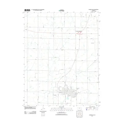
2012 Map of Cherryvale
USGS Topo · Published 2012About this map
Cherryvale sits as the central hub of this eastern Kansas landscape, where a dense grid of streets like W Main St and Independence Ave marks the town's core. The surrounding countryside is defined by a network of waterways including Drum Cr and Cherry Cr, which wind through the rural sections north of the settlement. Significant for local history and genealogy, several burial grounds are documented, including Hiltz Cem to the northwest and both Saint Francis Xavier Cem and Fairview Cem near the town limits. Modern infrastructure is prominent, represented by the Kansas Department of Transportation Montgomery County Rest Area and the Tri-City Airport to the northeast. The map provides a detailed view of the rural-to-urban transition, showing how established county roads like CR 6400 and 26000 Rd connect the agricultural outskirts to the residential heart of the community.
Find a feature on this map
50 named features on this map. Tap any name to fly to it.
Don’t see what you’re looking for? This feature index may not catch every label — zoom into the map to look around manually.
Map Details
Editions of this 2012 Cherryvale Map
This is the sole edition of this map. No revisions or reprints were ever made.
Other maps of this area

1886 · Independence
USGS Topo · 1:125,000

1886 · Parsons
USGS Topo · 1:125,000

1893 · Parsons
USGS Topo · 1:125,000

1894 · Independence
USGS Topo · 1:125,000

1905 · Independence
USGS Topo · 1:125,000

1945 · Parsons
USGS Topo · 1:62,500

1946 · Parsons
USGS Topo · 1:62,500

1946 · Mound Valley
USGS Topo · 1:62,500

1947 · Parsons
USGS Topo · 1:62,500

1947 · Joplin
USGS Topo · 1:250,000