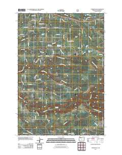
2011 Map of Cherryville
USGS Topo · Published 2011About this map
Cherryville and the surrounding rural communities of Bissell, George, and Dover anchor this study of the Clackamas County landscape as it appeared in the early 21st century. The map reveals a transition from agricultural use to private homesteads and timberland, marked by a dense network of residential roads such as SE George Rd and SE Firwood Rd. Natural water features are plentiful, including the North Fork Eagle Creek and the Eagle Creek Upper Falls, while numerous man-made bodies of water like Fleshman Reservoirs and Noble Acres Reservoir indicate historical water management for local irrigation or recreation. For genealogists and local historians, the George Cemetery serves as a critical point of interest, situated near the headwaters of Eagle Creek. The elevation is punctuated by landmarks like Lenhart Butte, overlooking a territory defined by its complex drainage into Deep Creek and the South Fork Eagle Creek.
Find a feature on this map
64 named features on this map. Tap any name to fly to it.
Don’t see what you’re looking for? This feature index may not catch every label — zoom into the map to look around manually.
Map Details
Editions of this 2011 Cherryville Map
This is the sole edition of this map. No revisions or reprints were ever made.
Other maps of this area

1911 · Boring
USGS Topo · 1:48,000

1914 · Boring
USGS Topo · 1:62,500

1916 · Estacada
USGS Topo · 1:125,000

1940 · Boring
USGS Topo · 1:62,500

1948 · Vancouver
USGS Topo · 1:250,000

1950 · Vancouver
USGS Topo · 1:250,000

1950 · Vancouver
USGS Topo · 1:250,000
1954 · Sandy
USGS Topo · 1:24,000
1954 · Estacada
USGS Topo · 1:24,000

1955 · Colton
USGS Topo · 1:62,500