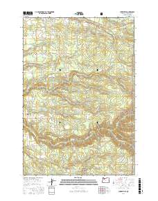
2017 Map of Cherryville
USGS Topo · Published 2017About this map
Bissell and the surrounding Clackamas County rural settlements sit amidst a landscape defined by the drainage of Eagle Creek and its many tributaries. The area is marked by a complex network of forest roads and local lanes like SE George Rd and SE Wildcat Mountain Dr, serving isolated homesteads and small agricultural plots. To the southeast, the terrain rises into the Mount Hood National Forest, where steep ridges and deep valleys predominate. Significant local water management is evident through numerous small impoundments such as Noble Acres Reservoir, Fleshman Reservoirs, and Todd Reservoir. The Eagle Creek National Fish Hatchery is a prominent institution in the southern portion of the quadrangle, situated near Eagle Creek Upper Falls. For local historians and genealogists, the George Cem and the central nodes of George, Dover, and Firwood provide clear points of reference for tracing family residences and rural community development.
Find a feature on this map
82 named features on this map. Tap any name to fly to it.
Don’t see what you’re looking for? This feature index may not catch every label — zoom into the map to look around manually.
Map Details
Editions of this 2017 Cherryville Map
This is the sole edition of this map. No revisions or reprints were ever made.
Other maps of this area

1911 · Boring
USGS Topo · 1:48,000

1914 · Boring
USGS Topo · 1:62,500

1916 · Estacada
USGS Topo · 1:125,000

1940 · Boring
USGS Topo · 1:62,500

1948 · Vancouver
USGS Topo · 1:250,000

1950 · Vancouver
USGS Topo · 1:250,000

1950 · Vancouver
USGS Topo · 1:250,000
1954 · Sandy
USGS Topo · 1:24,000
1954 · Estacada
USGS Topo · 1:24,000

1955 · Colton
USGS Topo · 1:62,500