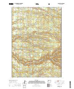
2020 Map of Cherryville
USGS Topo · Published 2020About this map
The community of George and the historic George Cem sit at the center of this Clackamas County landscape, where the agricultural plains transition into the timbered foothills of the Mount Hood National Forest. The geography is defined by a dense network of water resources, from the Eagle Creek National Fish Hatchery to numerous private impoundments like Coburns Pond and Timothy Reservoir. These water features, alongside the protected Eagle Creek Wild and Scenic River, illustrate a modern landscape still heavily shaped by its riparian corridors.
Find a feature on this map
89 named features on this map. Tap any name to fly to it.
Don’t see what you’re looking for? This feature index may not catch every label — zoom into the map to look around manually.
Map Details
Editions of this 2020 Cherryville Map
This is the sole edition of this map. No revisions or reprints were ever made.
Other maps of this area

1911 · Boring
USGS Topo · 1:48,000

1914 · Boring
USGS Topo · 1:62,500

1916 · Estacada
USGS Topo · 1:125,000

1940 · Boring
USGS Topo · 1:62,500

1948 · Vancouver
USGS Topo · 1:250,000

1950 · Vancouver
USGS Topo · 1:250,000

1950 · Vancouver
USGS Topo · 1:250,000
1954 · Sandy
USGS Topo · 1:24,000
1954 · Estacada
USGS Topo · 1:24,000

1955 · Colton
USGS Topo · 1:62,500