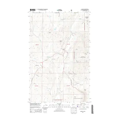
2014 Map of Chesaw
USGS Topo · Published 2014About this map
Chesaw and the mountain slopes of the Okanogan National Forest define this high-country landscape just south of the Canadian border. The 2014 survey reveals a network of winding mountain roads and significant peaks including Strawberry Mtn, Porphyry Peak, and Buckhorn Mtn. The settlement of Bolster lies in the northern section along Bolster Cr, part of a drainage system that includes Myers Cr and Mary Ann Cr. This map is particularly valuable for its detailed documentation of local access routes like Trap Line Loop Rd and Stage Coach Loop, which speak to the area's historical transportation patterns. High ridges such as Pontiac Ridge overlook a terrain dotted with small water bodies including Mary Ann Lake, Ads Lake, and Strawberry Lake. Lowland features such as Hungry Hollow contrast with the surrounding elevations, providing a clear view of the diverse topography of this part of Okanogan County.
Find a feature on this map
55 named features on this map. Tap any name to fly to it.
Don’t see what you’re looking for? This feature index may not catch every label — zoom into the map to look around manually.
Map Details
Editions of this 2014 Chesaw Map
This is the sole edition of this map. No revisions or reprints were ever made.
Other maps of this area

1902 · Osoyoos
USGS Topo · 1:125,000

1904 · Osoyoos
USGS Topo · 1:125,000

1904 · Republic
USGS Topo · 1:125,000

1951 · Bodie Mountain
USGS Topo · 1:62,500

1954 · Okanogan
USGS Topo · 1:250,000

1957 · Mt. Bonaparte
USGS Topo · 1:62,500

1958 · Okanogan
USGS Topo · 1:250,000

1958 · Bodie Mtn
USGS Topo · 1:62,500

1984 · Oroville
USGS Topo · 1:100,000

1984 · Republic
USGS Topo · 1:100,000