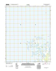
2013 Map of Chesconessex
USGS Topo · Published 2013About this map
Chesconessex sits at the edge of a complex coastal landscape where the land fragments into numerous marshes and islands between Pocomoke Sound and the Chesapeake Bay. This 2013 survey records the intricate tidal geography of Accomack County, where narrow waterways like Back Creek and Back Way Gut weave around landforms such as Savage Island, Russell Island, and Tobacco Island. The map illustrates a coastline defined by low-lying features including Long Ridge and the broad Guilford Flats. Local transport is concentrated along the southern edge, with Schooner Bay Rd and Wises Point Ln providing access to the waterfront at Factory Point. This detailed record of the marshy interior, including areas like Camp Island Gut and Rock Gut, is essential for understanding the shifting shoreline and local navigation points of the Virginia Eastern Shore.
Find a feature on this map
26 named features on this map. Tap any name to fly to it.
Don’t see what you’re looking for? This feature index may not catch every label — zoom into the map to look around manually.
Map Details
Editions of this 2013 Chesconessex Map
This is the sole edition of this map. No revisions or reprints were ever made.
Other maps of this area

1903 · Crisfield
USGS Topo · 1:62,500

1920 · Crisfield
USGS Topo · 1:62,500

1931 · Accomac
USGS Topo · 1:48,000

1935 · Accomac
USGS Topo · 1:62,500

1942 · Chesconessex
USGS Topo · 1:31,680

1942 · Nandua Creek
USGS Topo · 1:24,000

1942 · Great Fox Island
USGS Topo · 1:24,000

1942 · Tangier Island
USGS Topo · 1:24,000

1942 · Saxis
USGS Topo · 1:24,000

1942 · Parksley
USGS Topo · 1:24,000