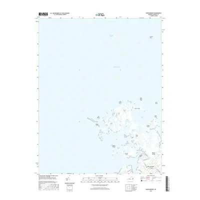
2016 Map of Chesconessex
USGS Topo · Published 2016About this map
Chesconessex sits along the coastal edge of the Virginia Eastern Shore, where the land fragmentizes into a maze of marshes and tidal guts at the junction of the Chesapeake Bay and Pocomoke Sound. This 2016 survey documents a landscape dominated by saltwater ecology, from the expansive Guilford Flats in the north to the network of islands including Russell Island, Savage Island, and Tobacco Island. The map illustrates the delicate balance of the Chesapeake shoreline, featuring narrow waterways like The Thorofare and Back Creek that carve through Big Marsh. While most of the sheet is aquatic or marshland, the small settlement at Chesconessex provides a terrestrial anchor, with local routes like Schooner Bay Rd and Deep Creek Rd leading toward the waterfront. This geographic record is particularly valuable for tracking the shifting shorelines of features like Long Ridge and Beach Island in an era of rising tides.
Find a feature on this map
30 named features on this map. Tap any name to fly to it.
Don’t see what you’re looking for? This feature index may not catch every label — zoom into the map to look around manually.
Map Details
Editions of this 2016 Chesconessex Map
This is the sole edition of this map. No revisions or reprints were ever made.
Other maps of this area

1903 · Crisfield
USGS Topo · 1:62,500

1920 · Crisfield
USGS Topo · 1:62,500

1931 · Accomac
USGS Topo · 1:48,000

1935 · Accomac
USGS Topo · 1:62,500

1942 · Chesconessex
USGS Topo · 1:31,680

1942 · Nandua Creek
USGS Topo · 1:24,000

1942 · Great Fox Island
USGS Topo · 1:24,000

1942 · Tangier Island
USGS Topo · 1:24,000

1942 · Saxis
USGS Topo · 1:24,000

1942 · Parksley
USGS Topo · 1:24,000