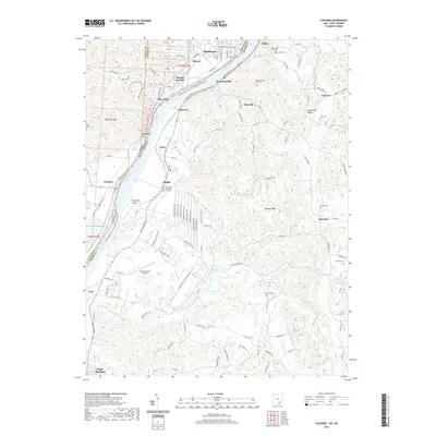
2019 Map of Cheshire
USGS Topo · Published 2019About this map
The Ohio River carves a deep valley through the borderlands of Ohio and West Virginia, anchoring a landscape defined by riverside industry and upland hollows. On the West Virginia side, the riverfront is dotted with settlements like West Columbia and Clifton, while the Ohio bank features the rail-hub of Hobson and the village of Cheshire. The topography transitions from the narrow floodplains of Eightmile Island to the dissected plateaus of Pike Hill and Mission Ridge, where numerous family-named cemeteries such as Zirkle Cem and Rickard Cem are tucked away in the hills. The southern reaches of the map show the outskirts of Point Pleasant and the Mason County Airport, illustrating the modern infrastructure that overlays this long-settled river corridor. Significant tracts of the Clinton F Mcclintic ST Wildlife area provide a contrast to the dense concentration of small communities and the active CSX rail lines that follow the water's edge.
Find a feature on this map
138 named features on this map. Tap any name to fly to it.
Don’t see what you’re looking for? This feature index may not catch every label — zoom into the map to look around manually.
Map Details
Editions of this 2019 Cheshire Map
This is the sole edition of this map. No revisions or reprints were ever made.
Other maps of this area

1907 · Pomeroy
USGS Topo · 1:62,500

1907 · Keno
USGS Topo · 1:62,500

1908 · Ravenswood
USGS Topo · 1:62,500

1908 · Point Pleasant
USGS Topo · 1:62,500

1926 · Ravenswood
USGS Topo · 1:62,500

1926 · Point Pleasant
USGS Topo · 1:62,500

1928 · Ravenswood
USGS Topo · 1:62,500

1929 · Point Pleasant
USGS Topo · 1:62,500

1947 · Columbus
USGS Topo · 1:250,000

1949 · Clarksburg
USGS Topo · 1:250,000