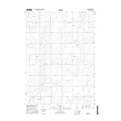
2017 Map of Chester
USGS Topo · Published 2017About this map
Chester and the small crossroads of Carlisle anchor this rural landscape in Eaton County, where agricultural fields are defined by a grid of township-line highways and historical drains. The northern reaches of the quadrangle are shaped by the winding Thornapple River and its tributary, the Little Thornapple River, which flow through the glacial terrain. Genealogy researchers will find several local burial grounds documented here, including Cogsdil Cem, Millerburg Cem, and West Carmel Cem, which serve as quiet markers of the area's 19th-century pioneer settlement. Evidence of specialized land use is found at the Wend Valley Airport near the center of the sheet. The complex drainage network, featuring the Dillon Relaid Drain and Nye and Eaton Drainage, illustrates the long-standing efforts to manage the low-lying wetlands and creek bottoms for productive farming in this part of Michigan.
Find a feature on this map
64 named features on this map. Tap any name to fly to it.
Don’t see what you’re looking for? This feature index may not catch every label — zoom into the map to look around manually.
Map Details
Editions of this 2017 Chester Map
This is the sole edition of this map. No revisions or reprints were ever made.
Other maps of this area

1918 · Battle Creek
USGS Topo · 1:62,500

1921 · Marshall
USGS Topo · 1:62,500

1923 · Marshall
USGS Topo · 1:62,500

1943 · Battle Creek
USGS Topo · 1:62,500

1943 · Marshall
USGS Topo · 1:62,500

1947 · Bellevue
USGS Topo · 1:24,000

1949 · Charlotte
USGS Topo · 1:62,500

1950 · Battle Creek
USGS Topo · 1:62,500

1950 · Nashville
USGS Topo · 1:62,500

1951 · Nashville
USGS Topo · 1:62,500