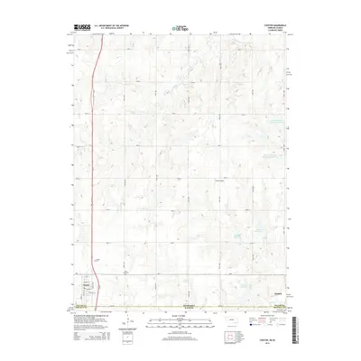
2014 Map of Chester
USGS Topo · Published 2014About this map
Chester, Nebraska, sits directly on the state line, where the local grid meets the Nebraska-Kansas border. This survey documents the intersection of rural agriculture and regional transport, with Us-81 cutting a north-south path through the rolling terrain. The landscape is defined by a series of small, named water catchments such as Schlife Reservoir and Laverentz Reservoir, which support the surrounding farms. Genealogists can find several historic burial sites, including Saint Johns Cem and the Chester Cem located north of the town center. To the east, Hubbell serves as another local hub along Ne-8, with the Hubbell Cem and Rose Cr marking its southern edge. The presence of Sutton Airport near Road E highlights the integration of light aviation into the rural landscape.
Find a feature on this map
32 named features on this map. Tap any name to fly to it.
Don’t see what you’re looking for? This feature index may not catch every label — zoom into the map to look around manually.
Map Details
Editions of this 2014 Chester Map
This is the sole edition of this map. No revisions or reprints were ever made.
Other maps of this area

1892 · Concordia
USGS Topo · 1:125,000

1893 · Washington
USGS Topo · 1:125,000

1898 · Hebron
USGS Topo · 1:125,000

1955 · Manhattan
USGS Topo · 1:250,000

1955 · Lincoln
USGS Topo · 1:250,000

1956 · Manhattan
USGS Topo · 1:250,000

1957 · Manhattan
USGS Topo · 1:250,000

1957 · Lincoln
USGS Topo · 1:250,000

1958 · Lincoln
USGS Topo · 1:250,000

1960 · Chester
USGS Topo · 1:24,000