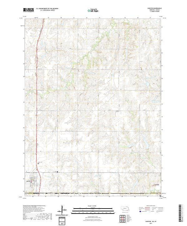
2021 Map of Chester
USGS Topo · Published 2021About this map
Chester and Hubbell anchor the southern boundary of this 2021 landscape, situated directly along the State Line Rd where Nebraska and Kansas meet. The township is defined by a rigorous grid of section lines and rural routes, including the prominent Meridian Rd and Stoddard Rd. Local history and genealogy are well-represented by the Chester Cem, Saint Johns Cem, and Hubbell Cem, which provide essential markers for family research in this agricultural corridor.
Find a feature on this map
38 named features on this map. Tap any name to fly to it.
Don’t see what you’re looking for? This feature index may not catch every label — zoom into the map to look around manually.
Map Details
Editions of this 2021 Chester Map
This is the sole edition of this map. No revisions or reprints were ever made.
Other maps of this area

1892 · Concordia
USGS Topo · 1:125,000

1893 · Washington
USGS Topo · 1:125,000

1898 · Hebron
USGS Topo · 1:125,000

1955 · Manhattan
USGS Topo · 1:250,000

1955 · Lincoln
USGS Topo · 1:250,000

1956 · Manhattan
USGS Topo · 1:250,000

1957 · Manhattan
USGS Topo · 1:250,000

1957 · Lincoln
USGS Topo · 1:250,000

1958 · Lincoln
USGS Topo · 1:250,000

1960 · Chester
USGS Topo · 1:24,000