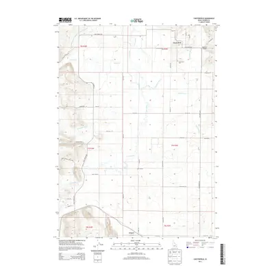
2013 Map of Chesterfield
USGS Topo · Published 2013About this map
The settlement of Chesterfield stands at the heart of this Idaho landscape, where the high desert meets a complex network of agricultural irrigation. In the early 21st century, the region's character is defined by the Portneuf River and its various tributaries and diversions, including the Portneuf Marsh Valley Irrigation Company Feeder Canal and Downey Canal. These water systems, alongside Toponce Cr and Eighteenmile Cr, support the rural life and ranching economy of Caribou County.
Find a feature on this map
45 named features on this map. Tap any name to fly to it.
Don’t see what you’re looking for? This feature index may not catch every label — zoom into the map to look around manually.
Map Details
Editions of this 2013 Chesterfield Map
This is the sole edition of this map. No revisions or reprints were ever made.
Other maps of this area

1917 · Portneuf
USGS Topo · 1:62,500

1948 · Bancroft
USGS Topo · 1:62,500

1949 · Bancroft
USGS Topo · 1:62,500

1954 · Pocatello
USGS Topo · 1:250,000

1955 · Preston
USGS Topo · 1:250,000

1958 · Pocatello
USGS Topo · 1:250,000

1958 · Preston
USGS Topo · 1:250,000

1962 · Preston
USGS Topo · 1:250,000

1968 · Bear Camp Gulch
USGS Topo · 1:24,000
1968 · Haystack Mtn
USGS Topo · 1:24,000