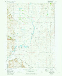
1981 Map of Chesterfield
USGS Topo · Published 1981About this map
Chesterfield stands as a focal point in this portion of the Portneuf Valley, where early Mormon settlement patterns are preserved through the Meeting House and the Chesterfield Church. The landscape is defined by the winding course of the Portneuf River and its numerous tributaries, including Toponce Creek and Eighteenmile Creek, which supported the agricultural development of this high-altitude basin. The transition from the valley floor to the Fish Creek Range in the south is marked by prominent local landmarks like Thirtyfive Mile Hill.
Find a feature on this map
30 named features on this map. Tap any name to fly to it.
Don’t see what you’re looking for? This feature index may not catch every label — zoom into the map to look around manually.
Map Details
Editions of this 1981 Chesterfield Map
This is the sole edition of this map. No revisions or reprints were ever made.
Other maps of this area

1917 · Portneuf
USGS Topo · 1:62,500

1948 · Bancroft
USGS Topo · 1:62,500

1949 · Bancroft
USGS Topo · 1:62,500

1954 · Pocatello
USGS Topo · 1:250,000

1955 · Preston
USGS Topo · 1:250,000

1958 · Pocatello
USGS Topo · 1:250,000

1958 · Preston
USGS Topo · 1:250,000

1962 · Preston
USGS Topo · 1:250,000

1968 · Bear Camp Gulch
USGS Topo · 1:24,000
1968 · Haystack Mtn
USGS Topo · 1:24,000