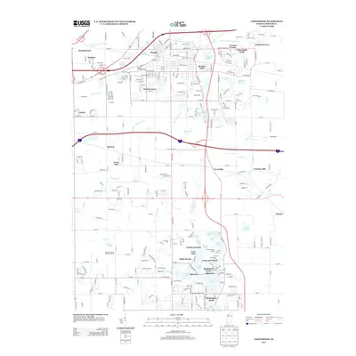
2013 Map of Chesterton
USGS Topo · Published 2013About this map
Porter and the surrounding Porter County landscapes are defined by an intricate network of waterways and residential developments as they appeared in 2013. The northern section is dominated by the E Arm Little Calumet River and a cluster of established neighborhoods like Western Acres, Morgan Park, and Graham Woods. To the south, the terrain shifts into a dense concentration of small glacial lakes, including Wauhob Lake, Long Lake, and Flint Lake, which have shaped the local character through recreational spaces like the Mink Lake Golf Course and Blackhawk Beach.
Find a feature on this map
91 named features on this map. Tap any name to fly to it.
Don’t see what you’re looking for? This feature index may not catch every label — zoom into the map to look around manually.
Map Details
Editions of this 2013 Chesterton Map
This is the sole edition of this map. No revisions or reprints were ever made.
Other maps of this area

1934 · Porter
USGS Topo · 1:48,000

1940 · Porter
USGS Topo · 1:62,500

1953 · Palmer
USGS Topo · 1:24,000

1953 · Wanatah
USGS Topo · 1:24,000

1953 · Garyton
USGS Topo · 1:24,000

1953 · Westville
USGS Topo · 1:24,000

1953 · Valparaiso
USGS Topo · 1:24,000

1953 · Ogden Dunes
USGS Topo · 1:24,000

1953 · Chesterton
USGS Topo · 1:24,000

1953 · Dune Acres
USGS Topo · 1:24,000