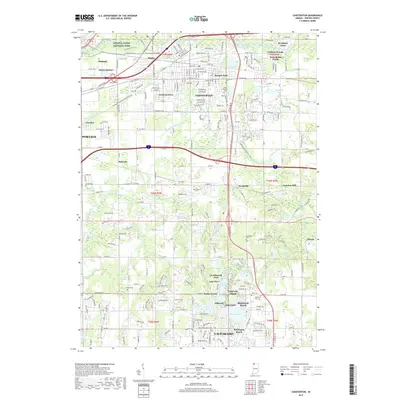
2019 Map of Chesterton
USGS Topo · Published 2019About this map
Indiana Dunes National Park anchors the northern reaches of this Porter County landscape, where the East Arm Little Calumet River winds through a complex of wetlands and dunes. The area is defined by the transition from the protected lakefront toward the industrial and residential growth of Chesterton and Portage. This survey captures the intricate drainage network south of the lake, including Peterson Ditch and Gustafson Ditch, which were essential for managing the low-lying terrain for development and agriculture.
Find a feature on this map
76 named features on this map. Tap any name to fly to it.
Don’t see what you’re looking for? This feature index may not catch every label — zoom into the map to look around manually.
Map Details
Editions of this 2019 Chesterton Map
This is the sole edition of this map. No revisions or reprints were ever made.
Other maps of this area

1934 · Porter
USGS Topo · 1:48,000

1940 · Porter
USGS Topo · 1:62,500

1953 · Palmer
USGS Topo · 1:24,000

1953 · Wanatah
USGS Topo · 1:24,000

1953 · Garyton
USGS Topo · 1:24,000

1953 · Westville
USGS Topo · 1:24,000

1953 · Valparaiso
USGS Topo · 1:24,000

1953 · Ogden Dunes
USGS Topo · 1:24,000

1953 · Chesterton
USGS Topo · 1:24,000

1953 · Dune Acres
USGS Topo · 1:24,000