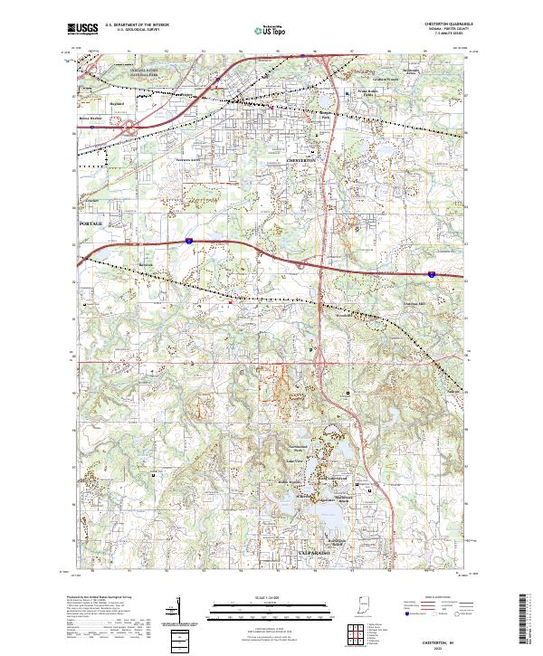
2022 Map of Chesterton
USGS Topo · Published 2022About this map
The Indiana Dunes National Park defines the northern landscape of this Porter County region, where the East Arm Little Calumet River snakes through a complex network of wetlands and ditches. This 2022 survey captures the modern expansion of Chesterton and Portage, showing how residential developments like Western Acres and Wake Robin Fields have integrated into the historical terrain. The map is particularly rich for those tracing local heritage, noting several established burial grounds including Saint Patricks Cem and the Dillingham Cem.
Find a feature on this map
70 named features on this map. Tap any name to fly to it.
Don’t see what you’re looking for? This feature index may not catch every label — zoom into the map to look around manually.
Map Details
Editions of this 2022 Chesterton Map
This is the sole edition of this map. No revisions or reprints were ever made.
Other maps of this area

1934 · Porter
USGS Topo · 1:48,000

1940 · Porter
USGS Topo · 1:62,500

1953 · Palmer
USGS Topo · 1:24,000

1953 · Wanatah
USGS Topo · 1:24,000

1953 · Garyton
USGS Topo · 1:24,000

1953 · Westville
USGS Topo · 1:24,000

1953 · Valparaiso
USGS Topo · 1:24,000

1953 · Ogden Dunes
USGS Topo · 1:24,000

1953 · Chesterton
USGS Topo · 1:24,000

1953 · Dune Acres
USGS Topo · 1:24,000