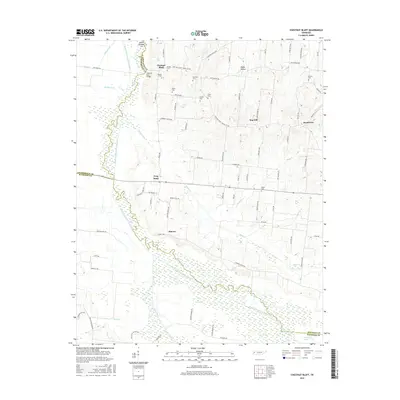
2016 Map of Chestnut Bluff
USGS Topo · Published 2016About this map
The South Fork Forked Deer River meanders across this West Tennessee landscape, creating a broad wetland corridor that separates Crockett, Lauderdale, and Haywood counties. Small agricultural communities such as Chestnut Bluff, Frog Jump, and Elmore dot the upland areas, connected by a network of rural routes including Chestnut Bluff Rd and Archer's Chapel Rd. The map reveals a high concentration of small family and community burial grounds, such as Young Cem, Albritton Cem, and Poston Cem, providing valuable points of reference for genealogical research.
Find a feature on this map
82 named features on this map. Tap any name to fly to it.
Don’t see what you’re looking for? This feature index may not catch every label — zoom into the map to look around manually.
Map Details
Editions of this 2016 Chestnut Bluff Map
This is the sole edition of this map. No revisions or reprints were ever made.
Other maps of this area

1939 · Halls
USGS Topo · 1:62,500

1952 · Gates
USGS Topo · 1:24,000

1952 · Bonicord
USGS Topo · 1:24,000

1952 · Chestnut Bluff
USGS Topo · 1:24,000

1952 · Fowlkes
USGS Topo · 1:24,000

1956 · Blytheville
USGS Topo · 1:250,000

1959 · Blytheville
USGS Topo · 1:250,000

1961 · Jones
USGS Topo · 1:24,000

1961 · Halls
USGS Topo · 1:62,500
1964 · Tibbs
USGS Topo · 1:24,000