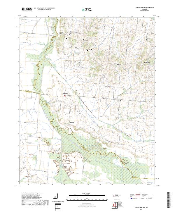
2022 Map of Chestnut Bluff
USGS Topo · Published 2022About this map
The South Fork Forked Deer River carves a winding path along the western boundary of this West Tennessee landscape, separating Lauderdale and Crockett counties. The river valley is defined by broad wetlands and seasonal water bodies like Bettis Lake and Moody Lake, while the eastern terrain rises into ridges such as Dog Hill and the distinctively named Happy Hollow. Small agrarian settlements and crossroads like Chestnut Bluff, Frog Jump, and Elmore anchor the local road network, which is predominantly comprised of rural routes named for local families.
Find a feature on this map
82 named features on this map. Tap any name to fly to it.
Don’t see what you’re looking for? This feature index may not catch every label — zoom into the map to look around manually.
Map Details
Editions of this 2022 Chestnut Bluff Map
This is the sole edition of this map. No revisions or reprints were ever made.
Other maps of this area

1939 · Halls
USGS Topo · 1:62,500

1952 · Gates
USGS Topo · 1:24,000

1952 · Bonicord
USGS Topo · 1:24,000

1952 · Chestnut Bluff
USGS Topo · 1:24,000

1952 · Fowlkes
USGS Topo · 1:24,000

1956 · Blytheville
USGS Topo · 1:250,000

1959 · Blytheville
USGS Topo · 1:250,000

1961 · Jones
USGS Topo · 1:24,000

1961 · Halls
USGS Topo · 1:62,500
1964 · Tibbs
USGS Topo · 1:24,000