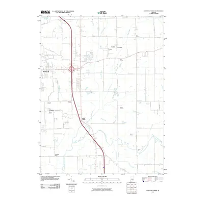
2010 Map of Chestnut Ridge
USGS Topo · Published 2010About this map
Seymour serves as the regional anchor on this 2010 survey of south-central Indiana, where the drainage of the East Fork White River and Vernon Fork Muscatatuck River shapes the local landscape. The map captures a transition between the developing outskirts of the city and the established rural settlements of Fleming, Conologue, and Chestnut Ridge. A network of small rural burial grounds, such as Wohrer Cemetery, Hunt Cemetery, and Barkman Cemetery, are preserved across the quadrangle, offering critical data points for genealogical research. The transportation corridor is defined by the proximity of the Comiskey Pike and Marion Pike railroads, while smaller local landmarks like Staples Ford and the Conologue Post Office mark points of historical local commerce and river crossings.
Find a feature on this map
72 named features on this map. Tap any name to fly to it.
Don’t see what you’re looking for? This feature index may not catch every label — zoom into the map to look around manually.
Map Details
Editions of this 2010 Chestnut Ridge Map
This is the sole edition of this map. No revisions or reprints were ever made.
Other maps of this area

1942 · Columbus
USGS Topo · 1:125,000

1953 · Cincinnati
USGS Topo · 1:250,000

1956 · Deputy
USGS Topo · 1:24,000

1956 · Louisville
USGS Topo · 1:250,000

1957 · Cincinnati
USGS Topo · 1:250,000

1957 · Jonesville
USGS Topo · 1:24,000

1957 · Azalia
USGS Topo · 1:24,000

1957 · North Vernon
USGS Topo · 1:24,000

1958 · Seymour
USGS Topo · 1:24,000

1959 · Tampico
USGS Topo · 1:24,000