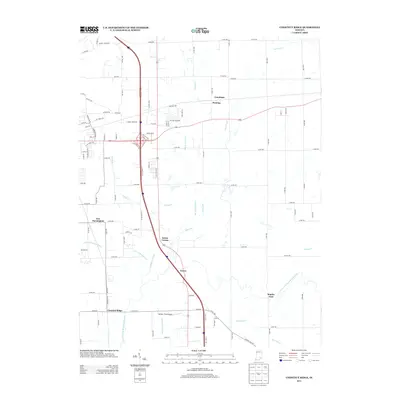
2013 Map of Chestnut Ridge
USGS Topo · Published 2013About this map
The Vernon Fork Muscatatuck River defines the lower drainage of this Jackson County landscape, where the rural character of southeastern Indiana meets the modern infrastructure of the I-65 corridor. Smaller hamlets and junctions like Conologue, Fleming, and Kriete Corner persist alongside more established points like New Farmington and the namesake Chestnut Ridge. The map illustrates a complex network of agricultural drainage, including the Luther McDonald Ditch and Mutton Creek Ditch, which support the surrounding farmlands. Near the southern boundary, Staples Ford marks a traditional river crossing point, while the presence of Stewart Field Airport indicates the region's continued importance for local transportation. This survey documents the intersection of historical settlement patterns with contemporary commercial development, notably seen at the cloverleaf near Tanger Blvd and Outlet Blvd.
Find a feature on this map
92 named features on this map. Tap any name to fly to it.
Don’t see what you’re looking for? This feature index may not catch every label — zoom into the map to look around manually.
Map Details
Editions of this 2013 Chestnut Ridge Map
This is the sole edition of this map. No revisions or reprints were ever made.
Other maps of this area

1942 · Columbus
USGS Topo · 1:125,000

1953 · Cincinnati
USGS Topo · 1:250,000

1956 · Deputy
USGS Topo · 1:24,000

1956 · Louisville
USGS Topo · 1:250,000

1957 · Cincinnati
USGS Topo · 1:250,000

1957 · Jonesville
USGS Topo · 1:24,000

1957 · Azalia
USGS Topo · 1:24,000

1957 · North Vernon
USGS Topo · 1:24,000

1958 · Seymour
USGS Topo · 1:24,000

1959 · Tampico
USGS Topo · 1:24,000