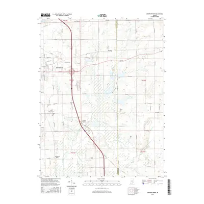
2016 Map of Chestnut Ridge
USGS Topo · Published 2016About this map
Seymour anchors the northwest corner of this Indiana landscape, where the urban grid gives way to the complex drainage systems of the Vernon Fork Muscatatuck River. The map illustrates a transition from the developed outskirts of the city to smaller crossroads like New Farmington and Kriete Corner. Genealogists will find a cluster of family-named burial sites across the township, including Barkman Cem, Gardner Cem, and Myers Cem, often situated near the creeks that defined early landholdings. The terrain is marked by an intricate network of waterways such as Mutton Creek Ditch and Sandy Branch, reflecting a history of agricultural drainage and flood management between the Jackson and Jennings county lines. Modern infrastructure like the Marion Pike and Stewart Field intersect with these older patterns of settlement and water management.
Find a feature on this map
69 named features on this map. Tap any name to fly to it.
Don’t see what you’re looking for? This feature index may not catch every label — zoom into the map to look around manually.
Map Details
Editions of this 2016 Chestnut Ridge Map
This is the sole edition of this map. No revisions or reprints were ever made.
Other maps of this area

1942 · Columbus
USGS Topo · 1:125,000

1953 · Cincinnati
USGS Topo · 1:250,000

1956 · Deputy
USGS Topo · 1:24,000

1956 · Louisville
USGS Topo · 1:250,000

1957 · Cincinnati
USGS Topo · 1:250,000

1957 · Jonesville
USGS Topo · 1:24,000

1957 · Azalia
USGS Topo · 1:24,000

1957 · North Vernon
USGS Topo · 1:24,000

1958 · Seymour
USGS Topo · 1:24,000

1959 · Tampico
USGS Topo · 1:24,000