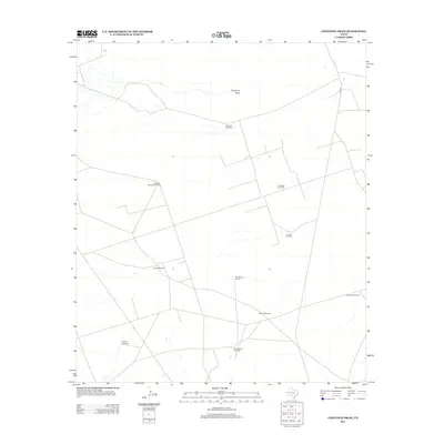
2012 Map of Cheyenne Draw
USGS Topo · Published 2012About this map
Cheyenne Draw serves as the primary drainage feature across this West Texas landscape in the early 21st century. The terrain is defined by a sparse but systematic industrial and ranching network, where the Crittendon Gas Field indicates the region's energy production. Most notable is the reliance on groundwater, evidenced by a series of named windmills scattered throughout the quadrangle, including Magnolia Windmill, Dooley Windmill, and the descriptive Windmill on the Hill.
Find a feature on this map
12 named features on this map. Tap any name to fly to it.
Don’t see what you’re looking for? This feature index may not catch every label — zoom into the map to look around manually.
Map Details
Editions of this 2012 Cheyenne Draw Map
This is the sole edition of this map. No revisions or reprints were ever made.
Other maps of this area

1954 · Hobbs
USGS Topo · 1:250,000

1954 · Pecos
USGS Topo · 1:250,000

1957 · Pecos
USGS Topo · 1:250,000

1958 · Hobbs
USGS Topo · 1:250,000

1969 · Cheyenne Draw SW
USGS Topo · 1:24,000

1969 · Jal
USGS Topo · 1:24,000

1970 · Brunson Ranch
USGS Topo · 1:24,000

1970 · Cheyenne Draw
USGS Topo · 1:24,000

1970 · Wink North
USGS Topo · 1:24,000

1970 · Cheyenne Draw SE
USGS Topo · 1:24,000