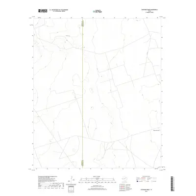
2019 Map of Cheyenne Draw
USGS Topo · Published 2019About this map
The arid Permian Basin landscape is defined by its intermittent drainage patterns and county boundaries, particularly where the Loving Co Winkler Co line bisects the western plains. This map focuses on a sparsely populated region where geography is dictated by seasonal watercourses and a minimalist network of local infrastructure. Cheyenne Draw meanders through the northern section of the map, carving a shallow path across the contours of the high desert. In the southeast, Monument Draw provides a second focal point for the natural drainage of the area. These features, along with a handful of rural routes like Co Rd 101 and Co Rd 104, illustrate the isolation and specialized land use common to the Texas-New Mexico borderlands during the early twenty-first century.
Find a feature on this map
5 named features on this map. Tap any name to fly to it.
Don’t see what you’re looking for? This feature index may not catch every label — zoom into the map to look around manually.
Map Details
Editions of this 2019 Cheyenne Draw Map
This is the sole edition of this map. No revisions or reprints were ever made.
Other maps of this area

1954 · Hobbs
USGS Topo · 1:250,000

1954 · Pecos
USGS Topo · 1:250,000

1957 · Pecos
USGS Topo · 1:250,000

1958 · Hobbs
USGS Topo · 1:250,000

1969 · Cheyenne Draw SW
USGS Topo · 1:24,000

1969 · Jal
USGS Topo · 1:24,000

1970 · Brunson Ranch
USGS Topo · 1:24,000

1970 · Cheyenne Draw
USGS Topo · 1:24,000

1970 · Wink North
USGS Topo · 1:24,000

1970 · Cheyenne Draw SE
USGS Topo · 1:24,000