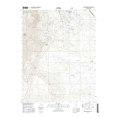
2016 Map of Cheyenne Mountain
USGS Topo · Published 2016About this map
Cheyenne Mountain dominates the western horizon of this landscape, where the steep grades of the Pike National Forest meet the expanding military and residential footprint south of Colorado Springs. The map reveals a complex network of recreational and access trails on the mountain slopes, including Medicine Wheel, Zook Loop, and Sundance. Below the peaks, the Limekiln Valley area shows significant modernization with a dense grid of named streets such as Normandy Rd and Remagen Rd, reflecting the area's deep ties to nearby military operations.
Find a feature on this map
86 named features on this map. Tap any name to fly to it.
Don’t see what you’re looking for? This feature index may not catch every label — zoom into the map to look around manually.
Map Details
Editions of this 2016 Cheyenne Mountain Map
This is the sole edition of this map. No revisions or reprints were ever made.
Other maps of this area

1893 · Colorado Springs
USGS Topo · 1:125,000

1909 · Colorado Springs
USGS Topo · 1:125,000

1942 · Colorado Springs
USGS Topo · 1:125,000

1948 · Mount Big Chief
USGS Topo · 1:24,000

1948 · Mount Pittsburg
USGS Topo · 1:24,000

1948 · Timber Mountain
USGS Topo · 1:24,000

1948 · Manitou Springs
USGS Topo · 1:24,000

1948 · Colorado Springs
USGS Topo · 1:62,500

1948 · Fountain
USGS Topo · 1:24,000

1948 · Colorado Springs
USGS Topo · 1:24,000