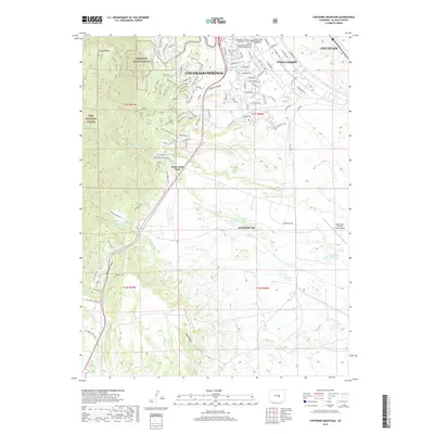
2019 Map of Cheyenne Mountain
USGS Topo · Published 2019About this map
Cheyenne Mountain AFS anchors the rugged western terrain of this El Paso County landscape, marking a significant military presence just south of Colorado Springs. This 2019 survey illustrates a complex intersection of defense installations and natural geography, where the prominent peak of Cheyenne Mtn overlooks the established corridors of Fort Carson and Peterson AFB. To the east, the landscape transitions toward Fountain along Fountain Cr, revealing a network of reservoirs like Haymes Reservoir and North Side Reservoir that support the region's semi-arid environment.
Find a feature on this map
108 named features on this map. Tap any name to fly to it.
Don’t see what you’re looking for? This feature index may not catch every label — zoom into the map to look around manually.
Map Details
Editions of this 2019 Cheyenne Mountain Map
This is the sole edition of this map. No revisions or reprints were ever made.
Other maps of this area

1893 · Colorado Springs
USGS Topo · 1:125,000

1909 · Colorado Springs
USGS Topo · 1:125,000

1942 · Colorado Springs
USGS Topo · 1:125,000

1948 · Mount Big Chief
USGS Topo · 1:24,000

1948 · Mount Pittsburg
USGS Topo · 1:24,000

1948 · Timber Mountain
USGS Topo · 1:24,000

1948 · Manitou Springs
USGS Topo · 1:24,000

1948 · Colorado Springs
USGS Topo · 1:62,500

1948 · Fountain
USGS Topo · 1:24,000

1948 · Colorado Springs
USGS Topo · 1:24,000