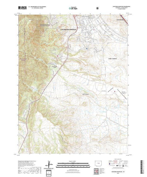
2022 Map of Cheyenne Mountain
USGS Topo · Published 2022About this map
Cheyenne Mountain Air Force Station anchors the western edge of this landscape, carved into the granite slopes of Cheyenne Mtn. This modern survey illustrates the proximity of high-intensity military infrastructure to the expanding urban reaches of Colorado Springs and Fountain. The eastern half is dominated by the sprawling grounds of Fort Carson, which includes specialized facilities such as Butts Army Airfield and educational centers like Pikes Peak Community College Fort Carson.
Find a feature on this map
96 named features on this map. Tap any name to fly to it.
Don’t see what you’re looking for? This feature index may not catch every label — zoom into the map to look around manually.
Map Details
Editions of this 2022 Cheyenne Mountain Map
This is the sole edition of this map. No revisions or reprints were ever made.
Other maps of this area

1893 · Colorado Springs
USGS Topo · 1:125,000

1909 · Colorado Springs
USGS Topo · 1:125,000

1942 · Colorado Springs
USGS Topo · 1:125,000

1948 · Mount Big Chief
USGS Topo · 1:24,000

1948 · Mount Pittsburg
USGS Topo · 1:24,000

1948 · Timber Mountain
USGS Topo · 1:24,000

1948 · Manitou Springs
USGS Topo · 1:24,000

1948 · Colorado Springs
USGS Topo · 1:62,500

1948 · Fountain
USGS Topo · 1:24,000

1948 · Colorado Springs
USGS Topo · 1:24,000