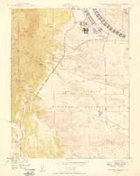
1949 Map of Cheyenne Mountain
USGS Topo · Published 1949About this map
Camp Carson dominates the eastern landscape of this post-war survey, showcasing the expansive infrastructure of the Camp Carson Military Reservation. The transition from the high plains to the dramatic rise of Cheyenne Mountain is marked by a mix of military development and remote educational outposts. Notably, the map records the Iowa State College Camp and the Louisiana State University Camp situated near the mountain's base, suggesting the area's significance for field research and collegiate training in the late 1940s.
Find a feature on this map
18 named features on this map. Tap any name to fly to it.
Don’t see what you’re looking for? This feature index may not catch every label — zoom into the map to look around manually.
Map Details
Editions of this 1949 Cheyenne Mountain Map
2 editions found
Other maps of this area

1893 · Colorado Springs
USGS Topo · 1:125,000

1909 · Colorado Springs
USGS Topo · 1:125,000

1942 · Colorado Springs
USGS Topo · 1:125,000

1948 · Mount Big Chief
USGS Topo · 1:24,000

1948 · Mount Pittsburg
USGS Topo · 1:24,000

1948 · Timber Mountain
USGS Topo · 1:24,000

1948 · Manitou Springs
USGS Topo · 1:24,000

1948 · Colorado Springs
USGS Topo · 1:62,500

1948 · Fountain
USGS Topo · 1:24,000

1948 · Colorado Springs
USGS Topo · 1:24,000