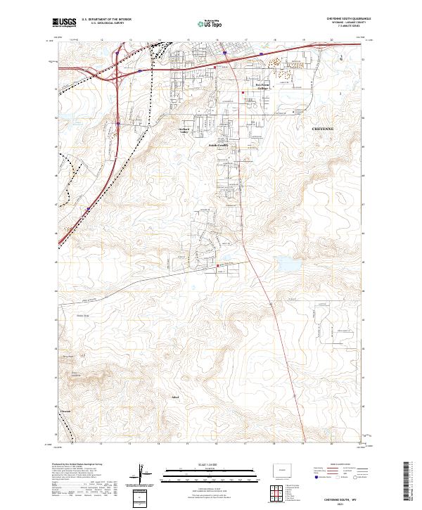
2021 Map of Cheyenne South
USGS Topo · Published 2021About this map
The southern outskirts of Cheyenne meet the high plains in this modern topographic study, where residential developments like Orchard Valley and South Greeley transition into the open range. The landscape is defined by its drainage patterns and geological formations, notably the Terry Anticline and Terry Peak in the southwest. The presence of Laramie County Community College near the Fox Farm-College area marks the educational hub of the region, while the northern edge of the map shows the dense grid of city streets south of W Lincolnway. Farther south, the terrain becomes increasingly open, dotted with smaller named localities such as Athol and Gleason. Water features like Swan Reservoir and the winding course of Crow Creek provide essential markers in a region otherwise dominated by broad draws and ranch roads like Terry Ranch Rd.
Find a feature on this map
68 named features on this map. Tap any name to fly to it.
Don’t see what you’re looking for? This feature index may not catch every label — zoom into the map to look around manually.
Map Details
Editions of this 2021 Cheyenne South Map
This is the sole edition of this map. No revisions or reprints were ever made.
Other maps of this area

1908 · Eaton
USGS Topo · 1:125,000

1910 · Eaton
USGS Topo · 1:125,000

1911 · Cheyenne
USGS Topo · 1:125,000

1914 · Cheyenne
USGS Topo · 1:125,000

1950 · Cheyenne
USGS Topo · 1:62,500

1954 · Cheyenne
USGS Topo · 1:250,000

1954 · Greeley
USGS Topo · 1:250,000

1957 · Greeley
USGS Topo · 1:250,000

1958 · Cheyenne
USGS Topo · 1:250,000

1958 · Greeley
USGS Topo · 1:250,000