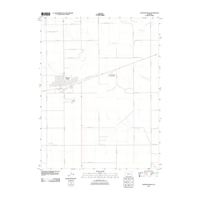
2010 Map of Cheyenne Wells
USGS Topo · Published 2010About this map
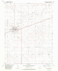
Cheyenne Wells serves as the focal point of this Eastern Colorado landscape, where a grid of rural roads and waterways defines the high plains environment. The town's layout is centered around the local transport network, including the Cheyenne Wells Municipal Airport positioned to its east. For those researching local family history, Fairview Cemetery is clearly marked south of the main settlement. The geography is dominated by a series of drainages, most notably the Smoky Hill River to the north and the winding paths of Ladder Creek and North Fork Ladder Creek to the south. The extensive naming of rural routes, such as County Road U and County Rd 49, illustrates the systematic division of land characteristic of the region's agricultural and ranching development.
Find a feature on this map
25 named features on this map. Tap any name to fly to it.
Don’t see what you’re looking for? This feature index may not catch every label — zoom into the map to look around manually.
Map Details
Editions of this 2010 Cheyenne Wells Map
This is the sole edition of this map. No revisions or reprints were ever made.
Other maps of this area

1892 · Cheyenne Wells
USGS Topo · 1:125,000

1894 · Cheyenne Wells
USGS Topo · 1:125,000

1954 · Lamar
USGS Topo · 1:250,000

1958 · Lamar
USGS Topo · 1:250,000

1981 · Cheyenne Wells
USGS Topo · 1:100,000
1982 · Cheyenne Wells NW
USGS Topo · 1:24,000
1982 · Arapahoe NW
USGS Topo · 1:24,000

1982 · Cheyenne Wells SW
USGS Topo · 1:24,000
1982 · Cheyenne Wells NE
USGS Topo · 1:24,000
1982 · Cheyenne Wells
USGS Topo · 1:24,000