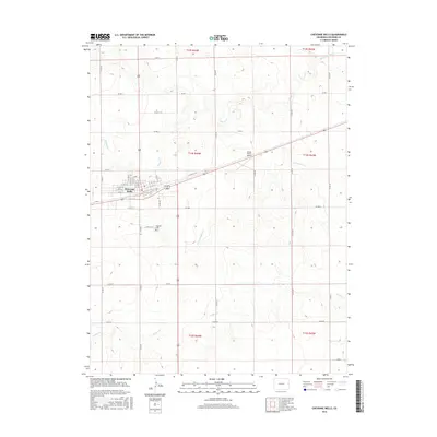
2016 Map of Cheyenne Wells
USGS Topo · Published 2016About this map
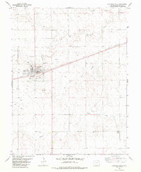
Cheyenne Wells stands as the primary seat of activity on this high plains landscape, organized around a geometric grid of streets like N 1st St W and S 1st St E. The town serves as a focal point for the surrounding agricultural community, where the drainage of the Smoky Hill River and various branches of Ladder Cr define the subtle topography. Just south of the main settlement, the Fairview Cem provides a point of interest for genealogists tracing local families in Cheyenne County. Transportation is central to the area's layout, anchored by the Windy Plains Airport to the east and a network of section-line roads such as Co RD S and Co RD Q that facilitate movement across the vast township divisions. This 2016 survey illustrates the persistent importance of water management in a semi-arid region, shown through the winding courses of Willow Cr and N Fork Ladder Cr.
Find a feature on this map
30 named features on this map. Tap any name to fly to it.
Don’t see what you’re looking for? This feature index may not catch every label — zoom into the map to look around manually.
Map Details
Editions of this 2016 Cheyenne Wells Map
This is the sole edition of this map. No revisions or reprints were ever made.
Other maps of this area

1892 · Cheyenne Wells
USGS Topo · 1:125,000

1894 · Cheyenne Wells
USGS Topo · 1:125,000

1954 · Lamar
USGS Topo · 1:250,000

1958 · Lamar
USGS Topo · 1:250,000

1981 · Cheyenne Wells
USGS Topo · 1:100,000
1982 · Cheyenne Wells NW
USGS Topo · 1:24,000
1982 · Arapahoe NW
USGS Topo · 1:24,000

1982 · Cheyenne Wells SW
USGS Topo · 1:24,000
1982 · Cheyenne Wells NE
USGS Topo · 1:24,000
1982 · Cheyenne Wells
USGS Topo · 1:24,000